Презентация Рельеф Казахстана онлайн
На нашем сайте вы можете скачать и просмотреть онлайн доклад-презентацию на тему Рельеф Казахстана абсолютно бесплатно. Урок-презентация на эту тему содержит всего 16 слайдов. Все материалы созданы в программе PowerPoint и имеют формат ppt или же pptx. Материалы и темы для презентаций взяты из открытых источников и загружены их авторами, за качество и достоверность информации в них администрация сайта не отвечает, все права принадлежат их создателям. Если вы нашли то, что искали, отблагодарите авторов - поделитесь ссылкой в социальных сетях, а наш сайт добавьте в закладки.
Оцените презентацию от 1 до 5 баллов!
- Тип файла:ppt / pptx (powerpoint)
- Всего слайдов:16 слайдов
- Для класса:1,2,3,4,5,6,7,8,9,10,11
- Размер файла:4.17 MB
- Просмотров:161
- Скачиваний:3
- Автор:неизвестен
Слайды и текст к этой презентации:
№1 слайд
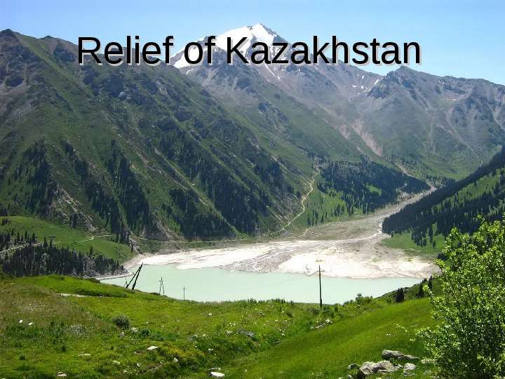
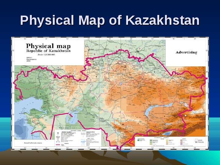
Содержание слайда: Relief of Kazakhstan
№2 слайд
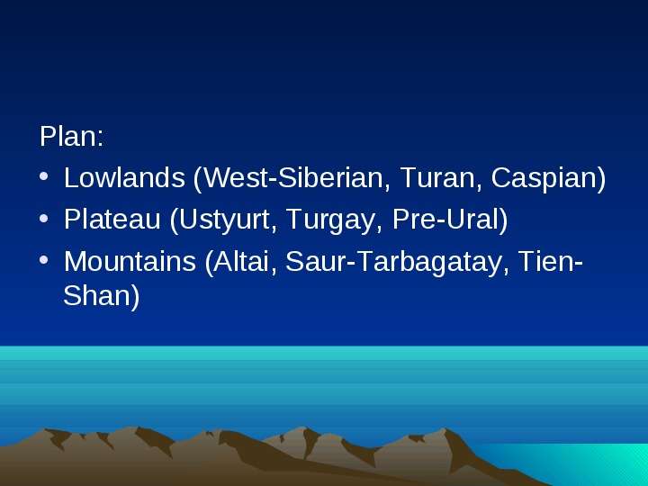
Содержание слайда: Plan:
Lowlands (West-Siberian, Turan, Caspian)
Plateau (Ustyurt, Turgay, Pre-Ural)
Mountains (Altai, Saur-Tarbagatay, Tien-Shan)
№3 слайд
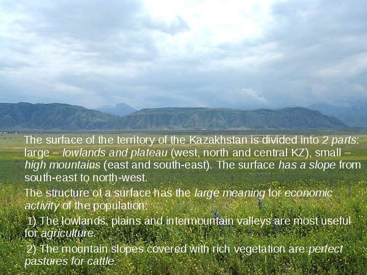
Содержание слайда: The surface of the territory of the Kazakhstan is divided into 2 parts: large – lowlands and plateau (west, north and central KZ), small – high mountains (east and south-east). The surface has a slope from south-east to north-west.
The surface of the territory of the Kazakhstan is divided into 2 parts: large – lowlands and plateau (west, north and central KZ), small – high mountains (east and south-east). The surface has a slope from south-east to north-west.
The structure of a surface has the large meaning for economic activity of the population:
1) The lowlands, plains and intermountain valleys are most useful for agriculture.
2) The mountain slopes covered with rich vegetation are perfect pastures for cattle.
№4 слайд
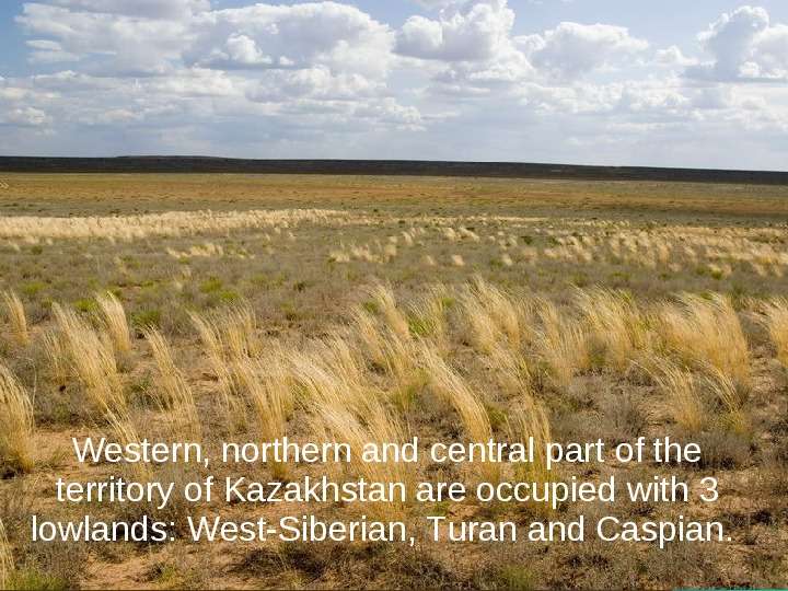
Содержание слайда: Western, northern and central part of the territory of Kazakhstan are occupied with 3 lowlands: West-Siberian, Turan and Caspian.
Western, northern and central part of the territory of Kazakhstan are occupied with 3 lowlands: West-Siberian, Turan and Caspian.
№5 слайд
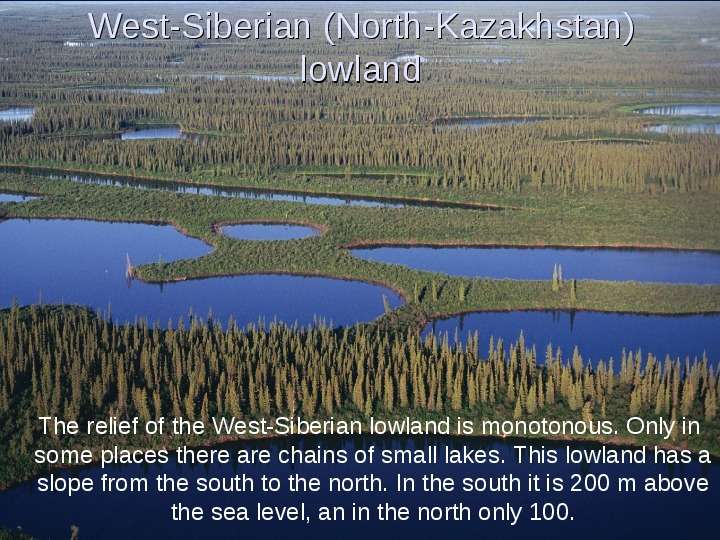
Содержание слайда: West-Siberian (North-Kazakhstan) lowland
The relief of the West-Siberian lowland is monotonous. Only in some places there are chains of small lakes. This lowland has a slope from the south to the north. In the south it is 200 m above the sea level, an in the north only 100.
№6 слайд
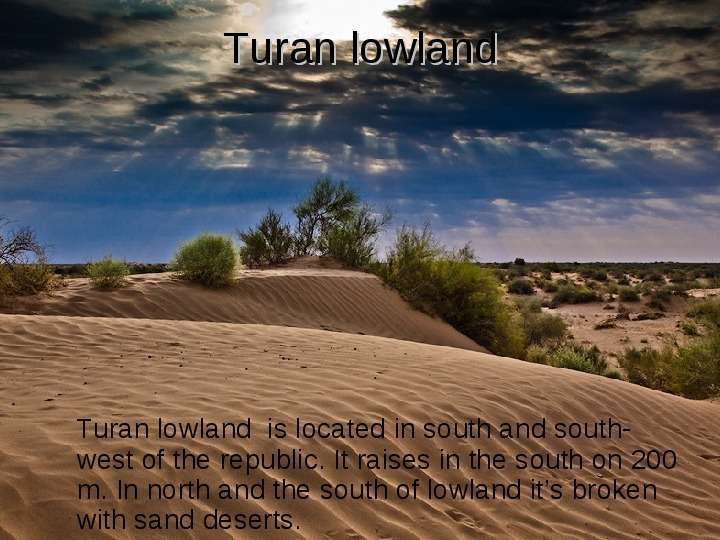
Содержание слайда: Turan lowland
Turan lowland is located in south and south-west of the republic. It raises in the south on 200 m. In north and the south of lowland it’s broken with sand deserts.
№7 слайд
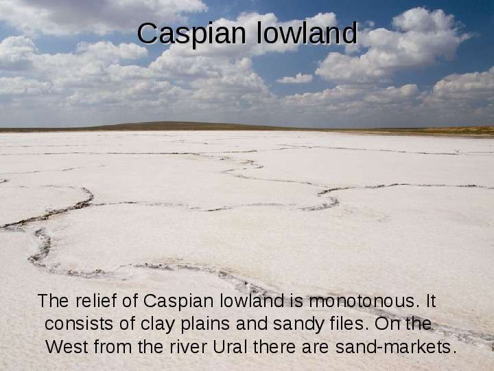
Содержание слайда: Caspian lowland
The relief of Caspian lowland is monotonous. It consists of clay plains and sandy files. On the West from the river Ural there are sand-markets.
№8 слайд
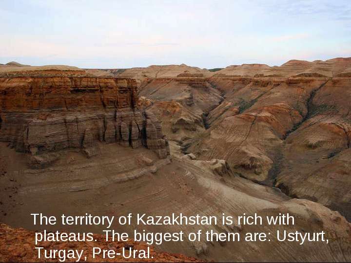
Содержание слайда: The territory of Kazakhstan is rich with plateaus. The biggest of them are: Ustyurt, Turgay, Pre-Ural.
№9 слайд
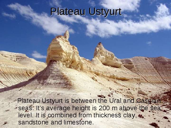
Содержание слайда: Plateau Ustyurt
Plateau Ustyurt is between the Ural and Caspian seas. It’s average height is 200 m above the sea level. It is combined from thickness clay, sandstone and limestone.
№10 слайд
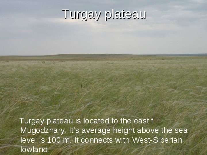
Содержание слайда: Turgay plateau
Turgay plateau is located to the east f Mugodzhary. It’s average height above the sea level is 100 m. It connects with West-Siberian lowland.
№11 слайд
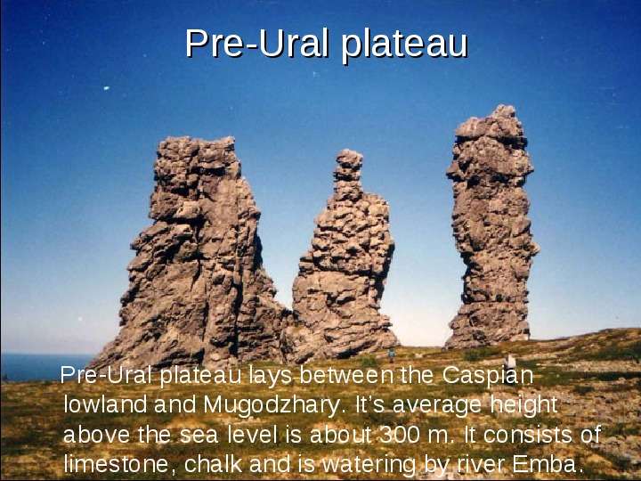
Содержание слайда: Pre-Ural plateau
Pre-Ural plateau lays between the Caspian lowland and Mugodzhary. It’s average height above the sea level is about 300 m. It consists of limestone, chalk and is watering by river Emba.
№12 слайд
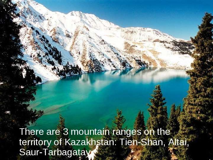
Содержание слайда: There are 3 mountain ranges on the territory of Kazakhstan: Tien-Shan, Altai, Saur-Tarbagatay.
№13 слайд
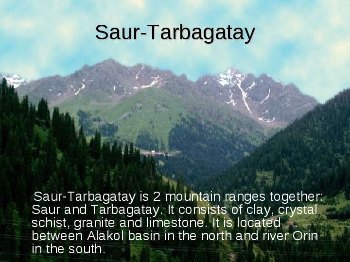
Содержание слайда: Saur-Tarbagatay
Saur-Tarbagatay is 2 mountain ranges together: Saur and Tarbagatay. It consists of clay, crystal schist, granite and limestone. It is located between Alakol basin in the north and river Orin in the south.
№14 слайд
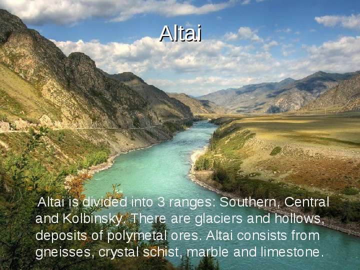
Содержание слайда: Altai
Altai is divided into 3 ranges: Southern, Central and Kolbinsky. There are glaciers and hollows, deposits of polymetal ores. Altai consists from gneisses, crystal schist, marble and limestone.
№15 слайд
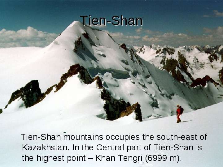
Содержание слайда: Tien-Shan
Tien-Shan mountains occupies the south-east of Kazakhstan. In the Central part of Tien-Shan is the highest point – Khan Tengri (6999 m).
№16 слайд
Содержание слайда: THE END
Скачать все slide презентации Рельеф Казахстана одним архивом: