Презентация Скачать презентацию Geography of the United Kingdom - География Соединенного Королевства онлайн
На нашем сайте вы можете скачать и просмотреть онлайн доклад-презентацию на тему Скачать презентацию Geography of the United Kingdom - География Соединенного Королевства абсолютно бесплатно. Урок-презентация на эту тему содержит всего 20 слайдов. Все материалы созданы в программе PowerPoint и имеют формат ppt или же pptx. Материалы и темы для презентаций взяты из открытых источников и загружены их авторами, за качество и достоверность информации в них администрация сайта не отвечает, все права принадлежат их создателям. Если вы нашли то, что искали, отблагодарите авторов - поделитесь ссылкой в социальных сетях, а наш сайт добавьте в закладки.
Оцените презентацию от 1 до 5 баллов!
- Тип файла:ppt / pptx (powerpoint)
- Всего слайдов:20 слайдов
- Для класса:1,2,3,4,5,6,7,8,9,10,11
- Размер файла:1.25 MB
- Просмотров:107
- Скачиваний:0
- Автор:неизвестен
Слайды и текст к этой презентации:
№1 слайд
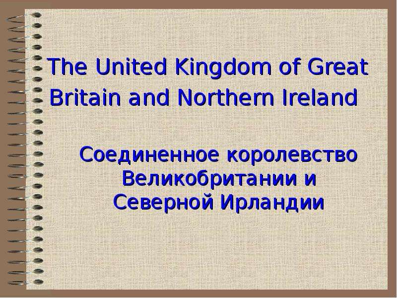
Содержание слайда: «География Соединенного Королевства»
№2 слайд
Содержание слайда: Geography of the United Kingdom
№3 слайд

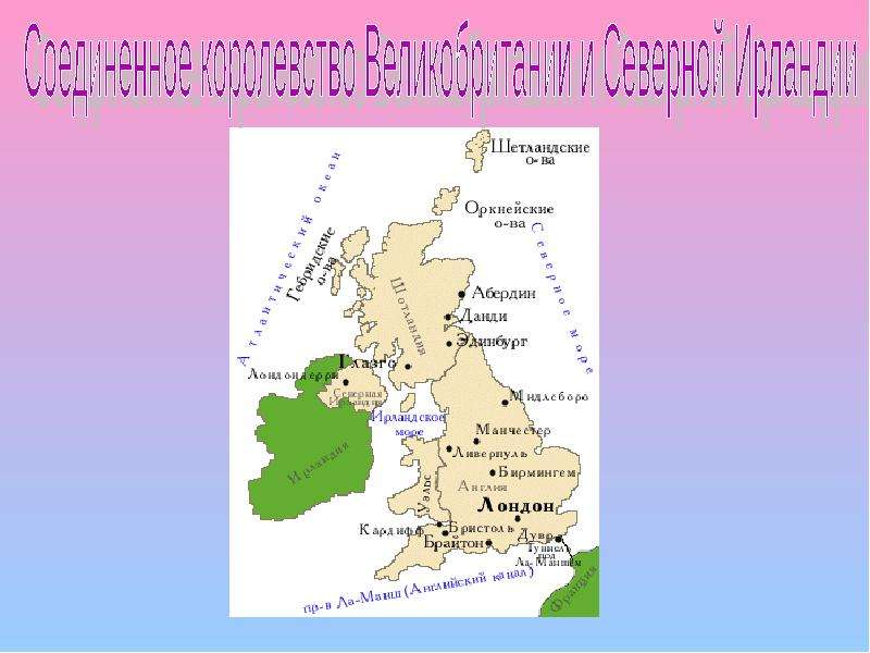
Содержание слайда: Geography location
The United Kingdom occupies a substantial part of the British Isles.
The United Kingdom of Great Britain and Northern Ireland, or UK, is in Western Europe. It comprises the island of Great Britain (England, Scotland and Wales) and the northeastern one-sixth of the island of Ireland (Northern Ireland), together with many smaller islands. The mainland areas lie between latitudes 49°N and 59°N (the Shetland Islands reach to nearly 61°N), and longitudes 8°W to 2°E. The Royal Greenwich Observatory, near London, is the defining point of the Prime Meridian. The United Kingdom has a total area of approximately 245,000 km².
№4 слайд
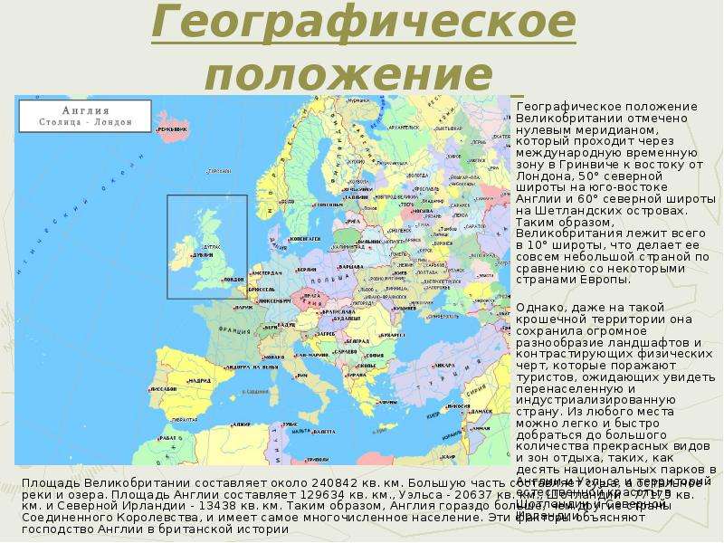
Содержание слайда: Географическое положение
Географическое положение Великобритании отмечено нулевым меридианом, который проходит через международную временную зону в Гринвиче к востоку от Лондона, 50° северной широты на юго-востоке Англии и 60° северной широты на Шетландских островах. Таким образом, Великобритания лежит всего в 10° широты, что делает ее совсем небольшой страной по сравнению со некоторыми странами Европы.
Однако, даже на такой крошечной территории она сохранила огромное разнообразие ландшафтов и контрастирующих физических черт, которые поражают туристов, ожидающих увидеть перенаселенную и индустриализированную страну. Из любого места можно легко и быстро добраться до большого количества прекрасных видов и зон отдыха, таких, как десять национальных парков в Англии и Уэльсе и территорий естественной красоты в Шотландии и Северной Ирландии.
№5 слайд

Содержание слайда: Physical geography
The physical geography of the UK varies greatly. It includes the chalk cliffs of Kent and Dorset, the rolling hills and fields of southeast England, the granite cliffs of Cornwall, the mountains of Wales, the uplands of the Peak District and the Pennines, the lakes and mountains of Cumbria, the Scottish lowlands, highlands and islands, and the fields, lakes and mountains of Northern Ireland. The country can be roughly divided into highland and lowland along the Tees-Exe line.
The exact centre of the island of Great Britain is disputed. Depending upon how it is calculated it can be either Haltwhistle in Northumberland, or Dunsop Bridge in Lancashire.
№6 слайд

Содержание слайда: Физическая География
№7 слайд

Содержание слайда: Geology
The geology of the United Kingdom is varied and complex. This gives rise to the wide variety of landscapes found across the UK. This variety, coupled with the early efforts of UK based scientists and geologists to understand it, has influenced the naming of many geological concepts, including many of the geological periods (for example, the Ordovician period is named after the Ordovices, a people of early Britain; the Devonian period is named after the county of Devon in south-west England).
The oldest rocks in the UK are gneisses which date from at least 2,700 Ma ("Ma" means "millions of years ago") in the Archaean Period, which are found in the far north west of Scotland and in the Hebrides, with a few small outcrops elsewhere. South of the gneisses are a complex mixture of rocks forming the North West Highlands and Grampian Highlands in Scotland, as well as the Connemara, Donegal and Mayo mountains of north Ireland. These are essentially the remains of folded sedimentary rock, deposited over the gneiss, from 1,000 Ma, with a notable 7 km thick layer of Torridon Sandstone being deposited about 800 Ma, as well as the debris deposited by an ice sheet 670 Ma.
№8 слайд

Содержание слайда: Mountains and hills
(Горы и Холмы)
№9 слайд

Содержание слайда: Mountains and hills
At 1,344 metres, Ben Nevis is the highest peak in the UK.
The ten tallest mountains in the UK are all found in Scotland. The highest peaks in each part of the UK are:
Scotland: Ben Nevis (Nevis Range, 1,344 metres)
Wales: Snowdon (Cambrian Mountains, 1,085 metres)
England: Scafell Pike (Cumbrian Mountains, 977 metres)
Northern Ireland: Slieve Donard (Mourne Mountains, 852 metres)
The ranges of mountains and hills in the UK include:
Scotland: Cairngorms, Cheviot Hills, Scottish Highlands, Southern Uplands,
Wales: Brecon Beacons, Cambrian Mountains, Snowdonia, Black Mountains,
England: Chilterns, Cotswolds, Dartmoor, Lincolnshire Wolds, Exmoor, Lake District,
Northern Ireland: Mountains of Mourne, Antrim Plateau, Sperrin Mountains
The lowest point of the UK is in the Fens of East Anglia, in England, parts of which lie up to 4 m below sea level.
№10 слайд

Содержание слайда: Горы и Холмы
Самая высокая точка Соединенного Королевства - Ben Nevis (1,344 м)
10 самых высоких гор UK находятся в Шотландии.
Cамые высокие пики каждой части UK:
Шотландия: Бен Невис (Nevis Range, 1,344 метра)
Уэльс: Сноудон (Cambrian Mountains, 1,085 метров)
Англия: Scafell Pike (Cumbrian Mountains, 977 метров)
Северная Ирландия: Slieve Donard (Mourne Mountains, 852 метра)
Горные цепи Соединенного Королевства:
Шотландия: Cairngorms, Cheviot Hills, Scottish Highlands, Southern Uplands,
Уэльс: Brecon Beacons, Cambrian Mountains, Snowdonia, Black Mountains,
Англия: Chilterns, Cotswolds, Dartmoor, Lincolnshire Wolds, Exmoor, Lake District,
Северная Ирландия: Mountains of Mourne, Antrim Plateau, Sperrin Mountains
А самая низкая точка UK - Fens of East Anglia(Англии), -4 метра над уровнем моря
№11 слайд
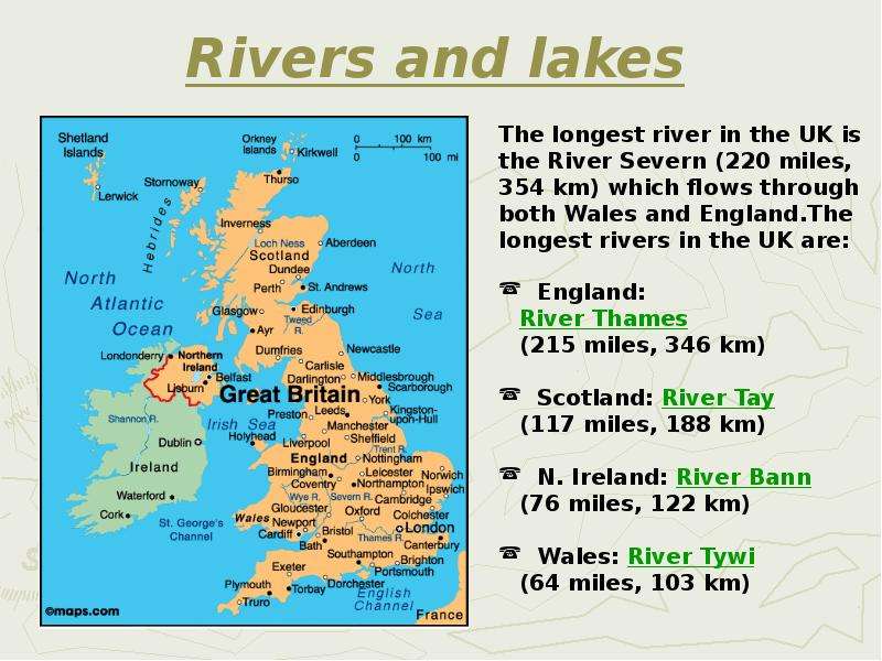
Содержание слайда: Rivers and lakes
№12 слайд
Содержание слайда: Реки и озера
№13 слайд
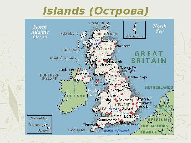
Содержание слайда: Islands (Острова)
№14 слайд

Содержание слайда: Islands
In total, it is estimated that the UK is made up of over 1000 small islands, some being natural and some being man-made crannogs, which were built in past times using stone and wood and which were enlarged by natural waste building up over time.
№15 слайд

Содержание слайда: Климат
№16 слайд
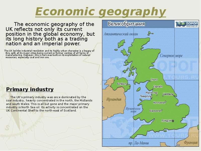
Содержание слайда: Economic geography
№17 слайд
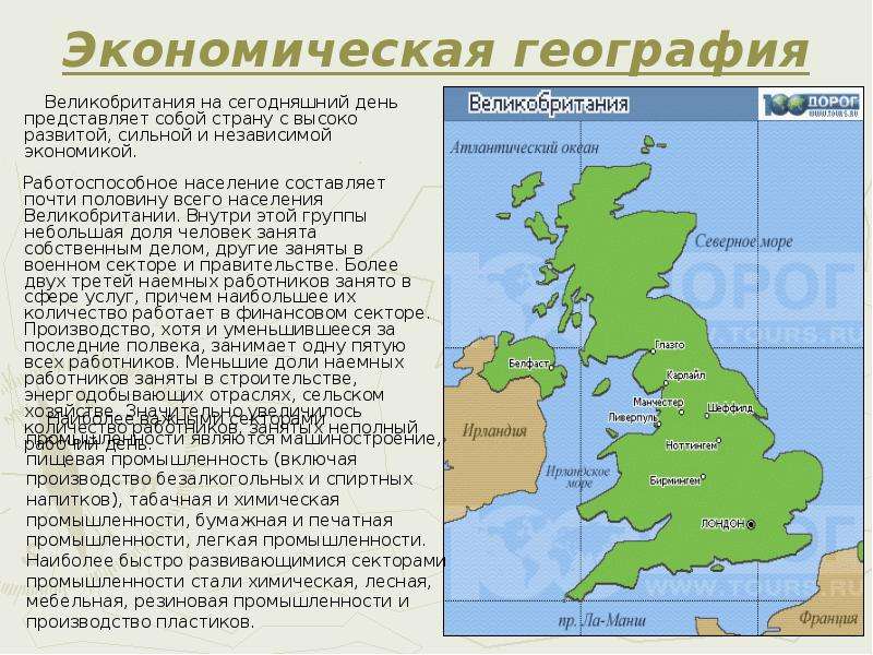
Содержание слайда: Экономическая география
№18 слайд
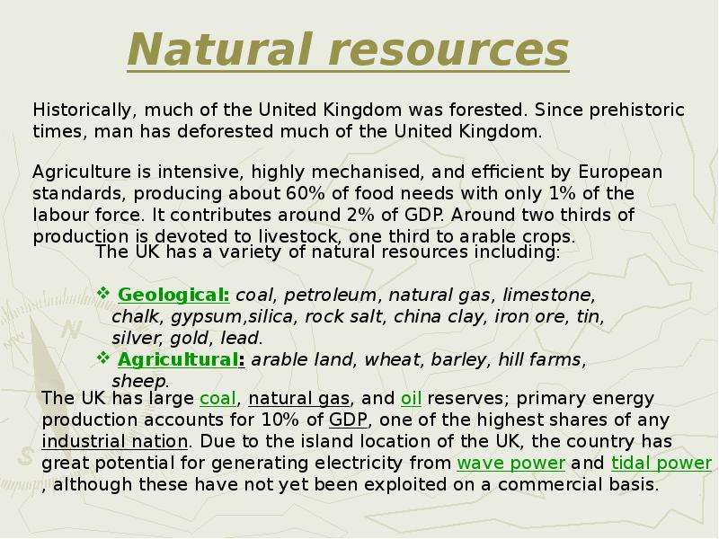
Содержание слайда: Natural resources
№19 слайд
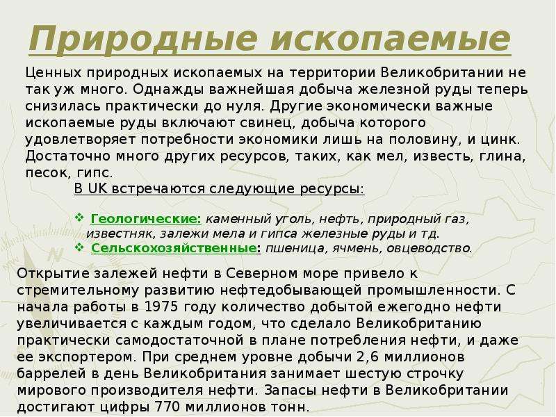
Содержание слайда: Природные ископаемые
№20 слайд

Содержание слайда: Благодарим за внимание
Благодарим за внимание
Thanks for attention
Скачать все slide презентации Скачать презентацию Geography of the United Kingdom - География Соединенного Королевства одним архивом: